Turning Drone Captures into Client-Ready Results
What an aerial imagery platform does for your workflow
When you fly a drone for a client, the work does not stop when the battery runs out. Raw footage and stills are only the start. The real value lies in what you do with that data afterward: stitching frames into orthomosaics, pulling measurements, adding annotations, and delivering everything in a format the client can actually use. An aerial imagery platform is the tool that handles those steps in one place, so you spend less time on file management and more time flying the next job.
From memory card to organized project
The first challenge after any flight is simply getting the data off the drone and into a system where you can see what you have. Most pilots land with hundreds of photos or a long video clip. Sorting through them manually, renaming files, and keeping track of which session belongs to which client quickly becomes tedious. A well-designed platform lets you upload everything at once, often through a browser or a dedicated app, and automatically groups the files by flight date, location, or project name. This means you can hand over raw files to the platform and get back a tidy folder structure without touching a single file name.
Once the data is in the system, the processing engine takes over. For aerial work, this usually means photogrammetry: aligning overlapping images to create a seamless map or a 3D model. The platform runs the calculations on its own servers, so you do not need a powerful computer or specialized software on your laptop. You simply select the images, choose the output type (an orthophoto, a point cloud, a digital surface model), and let the platform work. Depending on the size of the dataset, the result appears in minutes or hours, not days.
Visualizing and comparing data over time
A single orthomosaic is useful, but the real insight comes from comparing multiple flights over the same area. A construction site that changes week by week, a quarry where stockpiles shift, or a farm where crop health evolves across the season all benefit from a timeline view. An aerial imagery platform typically includes a map interface where you can overlay different dates side by side, swipe between them, or fade one into another. This makes changes obvious to the naked eye, which is far more convincing than a table of numbers.
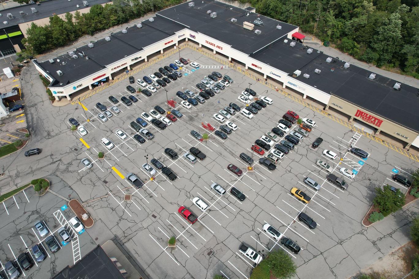
For measurements, the platform usually provides basic tools: distance, area, volume, and sometimes count. You can draw a polygon around a stockpile and get a volume estimate, or measure the length of a new road section. These measurements come from the georeferenced data, so they are accurate to the precision of the original flight. Clients often ask for a number they can trust, and a platform that lets them see the measurement on the image gives them that confidence.
Sharing without sending giant files
One of the most practical features of an aerial imagery platform is how it handles delivery. Raw drone files are large, and email is rarely an option. Even cloud storage links can be awkward if the client needs to view a 3D model or a high-resolution map without installing anything. A platform solves this by generating a shareable link that opens in any browser. The client sees the data exactly as you intended: a map they can pan and zoom, a 3D model they can rotate, or a report with annotations and measurements embedded. You control who sees it, and you can set permissions so the client cannot accidentally delete or alter the data.
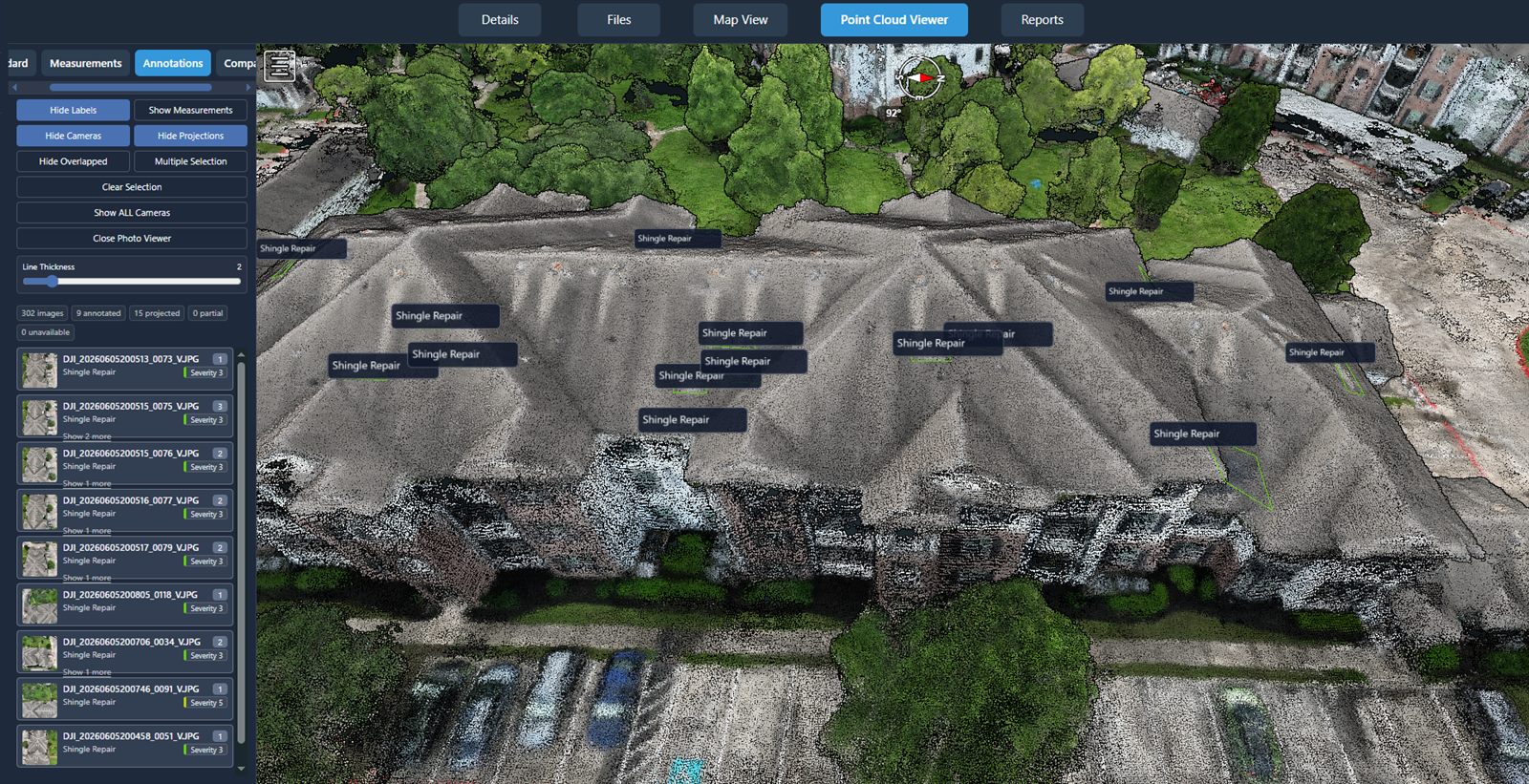
For teams that need to collaborate, the platform often allows multiple users to add comments, draw markup, or flag areas of interest. This turns a static deliverable into a living document where the client and your team can discuss what they see. It also creates an audit trail: every comment and change is logged, so there is no confusion about who said what or when a particular measurement was taken.
What to look for in an aerial imagery platform
Not every platform is the same, and the right one depends on the kind of work you do. Here are a few things to consider:
- Upload speed and file size limits. Some platforms cap file size or charge extra for large datasets. Check whether the platform handles the volume you typically fly.
- Processing options. Does it support photogrammetry for maps and models, or only basic stitching? Can you process video as well as stills?
- Measurement accuracy. If you need volume calculations or distance measurements, verify that the platform uses georeferenced data and that the results are reliable for your use case.
- Sharing and permissions. Look for password protection, expiry dates, and the ability to revoke access after the project ends.
- Integration with other tools. Some platforms let you export data to CAD, GIS, or BIM software. If your clients work in those environments, this can save a lot of conversion time.
One provider that offers a complete aerial data workflow is National Drone Services. Their platform covers uploading, processing, organizing, visualizing, comparing, measuring, and sharing drone data, with nationwide turnkey capture available for clients who need the flying done as well. For a pilot or a business that wants a single system for both capture and delivery, this kind of integrated approach can simplify the entire chain from flight to final product.
Making the most of the platform in your daily work
Using an aerial imagery platform well means building it into your standard operating procedure. After each flight, upload the data as soon as you return to the office or even from the field if the internet connection is strong enough. Tag the files with project metadata so they are easy to find later. Run processing overnight so the deliverables are ready by morning. Then share the link with the client and let them explore the data on their own time. This routine reduces the back-and-forth of answering questions about what a particular image shows or where exactly a measurement was taken.
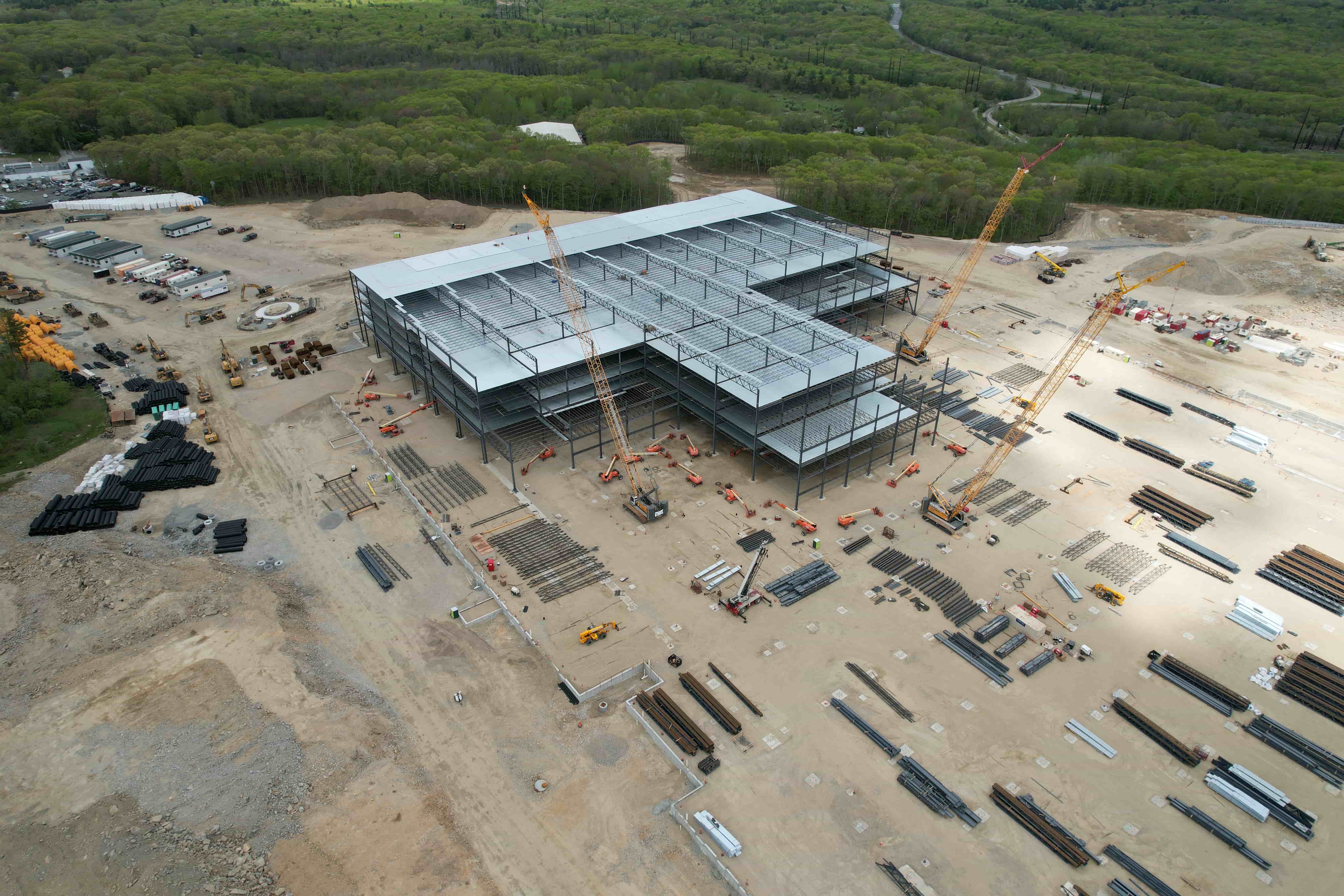
For recurring projects, such as weekly progress monitoring on a construction site, the platform becomes a historical record. You can show the client how the site looked a month ago versus today, and they can see the pace of work at a glance. This kind of visual evidence is hard to argue with and often leads to faster decisions, which is exactly what the client is paying for.
Avoiding common pitfalls
Even with a good platform, a few mistakes can undermine the quality of the deliverables. The most common is poor flight planning. If the images do not have enough overlap, the photogrammetry software cannot align them properly, and the resulting map will have gaps or distortions. Always plan your flight path with at least 70-80 percent overlap for stills, and fly at a consistent altitude and speed. The platform can only work with the data you give it.
Another issue is inconsistent lighting. If you fly under changing cloud cover, some images will be brighter than others, and the stitched result may show visible seams or color shifts. Try to fly when the light is even, or use a platform that offers color correction tools to balance the images after processing. Some platforms can adjust exposure and white balance automatically, but it is still better to start with uniform conditions.
Finally, remember that the platform is a tool, not a substitute for good piloting. The best software in the world cannot fix blurry images or a flight that missed the area of interest. Take the time to plan each mission, check the camera settings, and review the data before you leave the site. A quick glance at the screen during the flight can save hours of rework later.
In the end, an aerial imagery platform is about turning raw captures into something your client can act on. It removes the grunt work of file management and processing, and it gives you a professional way to present results. For a business like National Drone Services, the platform is the bridge between the drone and the decision-maker. Whether you fly your own missions or rely on a capture service, having that bridge in place makes every project run more smoothly and leaves a stronger impression on the people who matter most: your clients.
National Drone Services on social media
 Facebook